

Divided highways are excellent visual navigation aids, if one happens to be going in your direction. Railroads, by comparison are pretty poor. When Cal Rodgers flew the first airplane across the US in 1911, railroads were about all he had to navigate by. He had state maps, nothing like a modern sectional chart.
 Following a course line on a sectional chart is the most basic method of aerial navigation. In the 1930s through the 1950s, four-course radio ranges were used. You can see the "beams" of one just to the west of Detroit in this sectional:
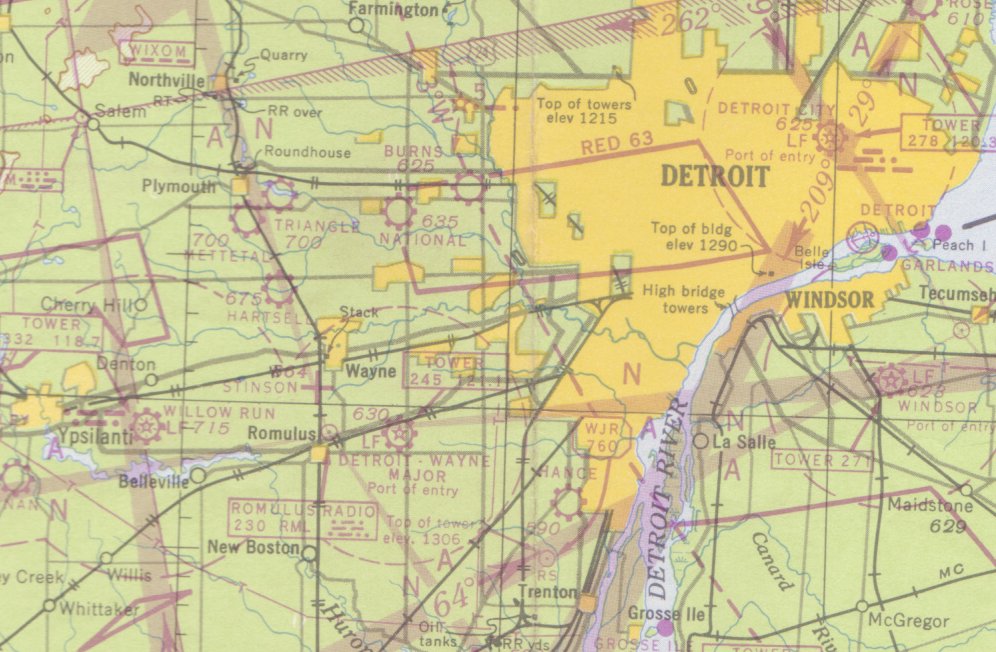 All you needed to fly those was an AM receiver, a set of headphones and a magnetic compass. If you were "on the beam", you heard a steady tone. If you were off to one side, you heard Morse code for A (.-) or N (-.). And you needed a ton of smarts, because if you were lost, finding out which side of the station you were on took a lot of know-how. Some of the "beams" could be bent by weather conditions and in thunderstorms, all bets were off.
Four-course ranges were replaced by VHF Omni-directional Ranges, or VORs. You dial in the frequency, dial in the bearing and fly to or from the station. If you scroll back up to the first chart, the large circle northeast of Topeka indicates a VOR station. Draw a line on the chart to the station, note the number on the bearing circle and that is the radial bearing from the station. You fly that away from the station and you fly the reciprocal bearing to the station.

Easy as pie, especially compared to trying to find your way by a sectional over rural Illinois, where all of the small towns look the same from 4,500'.
OMEGA was used in high-end airplanes for many years, but the OMEGA stations were shut down ten years ago as GPS came online. LORAN was also used in airplanes, although it was developed for maritime use. VORs are still in wide use, though it's pretty clear that the Feds want to shut them down soon.


1 comment:
Post a Comment